 |
|

|
Gojome Map
Gojome Map for Strollers
Visiting Shitamachi’s history
Gojome Road Map
“Tsurikichi Sanpei” shooting cites tour

Gojome Map for Strollers
Visiting Shitamachi’s historyGojome Road Map
“Tsurikichi Sanpei” shooting cites tour
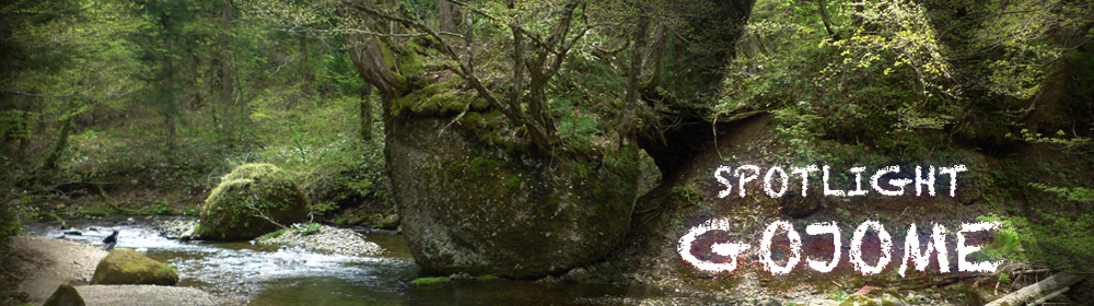
Nature
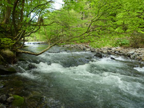
Babame River
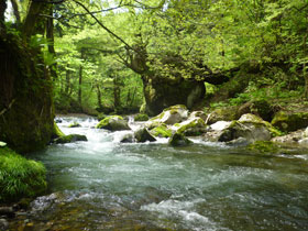
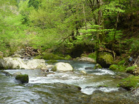
The Babame River, the longest river in Akita, is the second-class river with the lengths of 47.5 km which stream comes from Babame dake. Areas near the source of the Babame River including Usunai Valley、Kawadai Valley are just as beautiful as Towada-Oirase. The Sankai Waterfall with a fall of 25 m is also worth seeing. In the upper river, iwana and yamame (kind of river trout) are plentifully available and it is popular for stream fishing. In August, the Babame River Rafting Festival is held jointly organized by youth and women’s groups of the Koto Chamber of Commerce and Industry. In the festival, the local people appeal to prevent water contamination in Babamecho River and Hachiro-gata.
Giant Trees
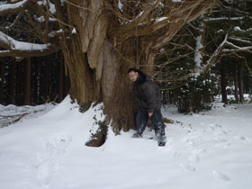
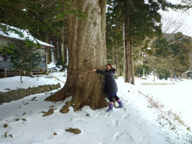
A giant tree is identified as a tree with the circumstances of over 300 m at the height of 130 cm from the grand. There are approximately 50 giant trees in Gojome-machi mainly in cites of shrines and temples. The figure of the giant trees strongly standing in the wind and snow with deeply stretched roots is always overwhelming. At the same time, it is very healing to face at them, sensing the vigorous and mysterious power generated from the witness of history.
There may be a giant tree not found yet. When you visit Gojome-machi, why don't you look for one and sense its power?
Nekobari Rock
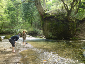
Almost nobody except for the local timber industry related people has ever visited the area on the way passing through Kitanomata to Babame-dake. It is located by the upper stream of the Babame River which is popular fishing cites and also a location used in the film “Tsurikichi Sanpei”. Nekobari Rok is a giant rock with a giant tree growing on it. The root of the tree widely worked down on the surface of the rock and reached the ground. Local people affectionately named it Nekobari Rock, feeling attached to its unique appearance digging the roots in the air.
Access: 5 minutes drive from Kita-no-mata Village (approx. 2 km)
※The road is close to traffic because of the snow during winter season (from mid- Dec. to mid-April)
Mountains
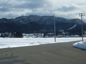
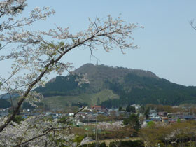
Mt. Moriyama is a mountain formed by two peaks in Gojome, which was often featured in folk tales. The second peak is lower and accessible by car and you can view Gojome-machi, Hachiro-ko and the reclaimed land, and Japan Sea from the top of the mountain. In a sunny day, you can also see Mt. Chokai. Please also try to clime up the first peak if you have enough physical capacity. Mt. Moriyama is known as the north limit for bell cricket habitat.
Babame-dake (1,037km) is located in the Taiheizan Prefectural Nature Park. Climbing up approximately 4 km from the entrance in Hikarisawa Enchi will lead you to the mountain top with a grand panoramic view. You can enjoy seeing primeval beech forest and alpine plants on the way.
※ The road are closed at a point of about 4 km from Kita-no-mata because of damaged road shoulders.